Martim Moniz
A portrait of the present
Find out about some of the socio-demographic indicators and other information on the environment, mobility and infrastructure.
A perspective on the past
Here you can find the historical evolution of this place, which dates back 8,000 years to the Neolithic settlement on the slopes of Sant'Ana.
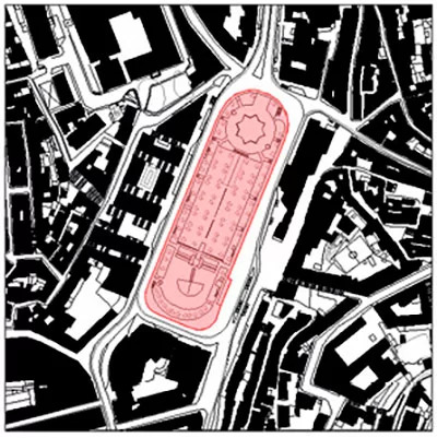
Portrait of the area to be redeveloped
Summary of statistical indicators in the context of the Square
Central position within the city, just a few minutes' walk from important public spaces (Praça da Figueira, Praça do Rossio, Praça do Comércio, Frente Ribeirinha);
Confluence of different urban fabrics (Baixa Pombalina, Mouraria and more recently built areas);
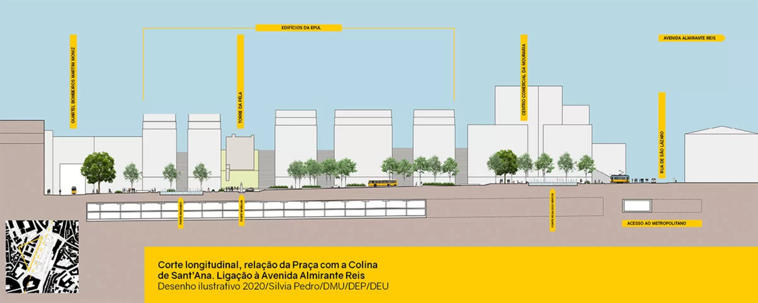
Existence of two structuring pedestrian axes: Transversal axis of the staircases (Escadinhas do Jogo da Pêla, - Escadinhas da Saúde); - Longitudinal axis of Rua da Palma;
Existence of water features;
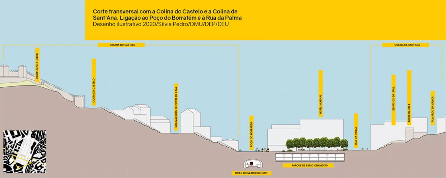
Location in a valley (system of views, perspectives and rooftops), highlighting the panoramic views over the Castle;
There are no benches or rest areas;
Multimodal transportation zone (buses, tourist buses, tuk tuks, cabs, streetcars, metro, cars, subway parking). Martim Moniz is served by various types of transport and is located close to the river terminals;
Strong commercial character (two shopping centers, local shops in the surrounding streets).
very intense road traffic, making pedestrian circulation difficult throughout the square and intense noise pollution (the square acts as a large traffic circle);
pedestrian safety when crossing the square;
poorly shaded space. Insipid tree structure;
few seating and meeting areas in the central plaza;
location in a valley (system of views, perspectives and rooftops), highlighting the panoramic views of the Castle;
very high levels of road noise;
pedestrian areas with cluttered elements and reduced width;
the square's central plaza is poorly accessible and difficult to cross, with occasional access via stairs most of the time;
poor accessibility to the central plaza from the surrounding areas;
the central plaza has no leisure or sports facilities;
the Fernandina Wall monument divides the space, creating an obstacle;
overloaded passenger pick-up areas (streetcar 28E);
degraded area around the Church of São Domingos.
Socio-demographic information
The methodology used for the sociodemographic characterization consisted of processing data from the population and housing censuses carried out in 2021, corresponding to the statistical subsections contained in a 500-metre area surrounding Martim Moniz Square;
Martim Moniz and its surroundings are characterized by their multiculturalism, corresponding to the place in Lisbon where the greatest number of ethnic groups meet and where the most examples of commerce related to South and Southwest Asian cultures can be found. However, knowledge of this reality cannot be gauged by census data and a specific survey would be necessary.
Housing
over 73% of buildings with a residential function were built or altered before 1946 and 16.5% before 1980;
only 5.6% of buildings were built between 1981 and 2000 and 4.7% between 2001 and 2021;
of the total number of residential buildings, 1,651 were exclusively residential and 637 were of another type or mixed;
the demographic structure of Martim Moniz and its surroundings has become younger than in the previous census, largely due to the increase in the relative weight of the 15-64 age group.
of the 10,220 existing dwellings (351 less than in 2011), 99.7% were family dwellings and 36.6% of these, a very high number, were vacant or secondary dwellings;
residential occupancy was mainly rented (63.7%), with resident owners accounting for 29.5% of all family dwellings.
The average occupancy rate was 1.5 people per dwelling
Dwellings in the Martim Moniz area in 2011
| N | % | |
|---|---|---|
| Total number of dwellings | 10.220 | 100 |
| Family dwellings | 10.192 | 99,7 |
| Habitual residence dwellings | 6.456 | 63,2 |
| Habitual residence dwellings with owner occupier | 1.907 | 29,5 |
| Habitual residence dwellings rented out | 4.113 | 63,7 |
| Vacant dwellings or secondary residence | 3.733 | 36.6 |
Source: INE, Census 2021
Population
more than half of the total population was of working age (62.3%);
in terms of age distribution, the young population (aged 14 or under) accounted for 9.3% and the elderly population (aged 65 or over) accounted for 19.4%;
for every young person under 15 there were almost 2.1 elderly people, a figure higher than the city average of 1.8;
the demographic structure of Martim Moniz and its surroundings was younger than in the previous census, largely due to the increase in the relative weight of the 15-64 age group.
Population of the Martim Moniz area in 2021 by major age groups
| 0-14 | 15-24 | 25-64 | 65 e + | Total population | |
| Population % | 1.389 9,3 | 1.335 9 | 9.276 62,3 | 2.883 19,4 | 14,883 100 |
Source: INE, Census 2021
consists of 6,479 households, of which 3,220 (49.7%) are family nuclei;
51.3% of households are made up of individuals with apparently no family relationship.
Environment - Characterization reports
The central square of Martim Moniz has a large expanse of green space and trees on the slab of the underground parking lot.
The tree species present in the slab areas are Brachychiton populneus and Quercus palustris . Being very different species, they also have different behaviors, with the great decline of the Brachychiton populneus being noticeable in relation to the Quercus , which are vigorous.
The dominant species present apart from those described above are Citrusx aurantium, Cercis siliquastrum, Pyrus calleryana var. Chanticleer.
Total number of trees - 86
Total number of shrubs - 167
A perspective on the past
A place of secular human settlement, the square remains a faithful witness to different times, people and cultures. People and ideas live, converge and cross paths around it.
Human occupation of this place dates back 8,000 years to the Neolithic settlement on the slopes of Sant'Ana, located on the banks of the Regueirão dos Anjos, in the Mouraria valley.
It wasn't until the Middle Ages that human settlement on this site became more significant. In the 14th century, the area corresponding to the current square was crossed by the Cerca Fernandina (1373-1375), a walled structure that delimited the city and of which traces still remain in the area today, such as the Torre do Jogo da Péla and the Inscription Commemorating the construction of said fence.
At the beginning of the second half of the 16th century, Rua Nova de Palma was opened, occupying part of the existing vegetable gardens and creating a new urbanized area. A century later (17th century) this street extended northwards, growing in buildings.
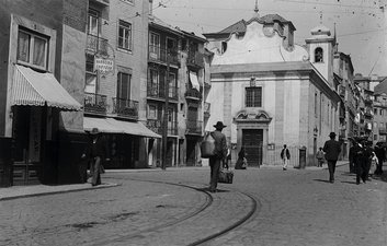
The earthquake of 1755 affected part of this area - some of the buildings at the southeast foot of the Sant' Ana slope collapsed or suffered serious damage, while others survived, such as the Chapel of Nossa Senhora da Saúde and the Church of Socorro.
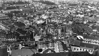
At the end of the 19th century, the city was growing in people and activity. The land located in the valley, bordering the Mouraria neighborhood and yet to be occupied, would give way to blocks with streets, courtyards and alleys, where densely inhabited buildings predominated. The proximity of this new urban agglomeration to the centuries-old neighborhood led it to be identified as an extension of the old "mouraria" (the name given to the ghetto for the "Moors" expelled from the interior of the city after the Christian conquest of Lisbon in 1147).
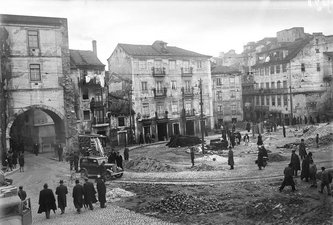
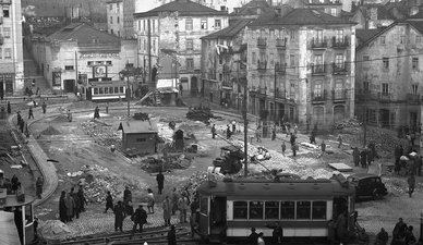
In the 20th century, between 1930 and 1960, this area became the focus of the new civilizing urbanism, based on the principles of hygiene and beautification, considering the old city as an impediment to progress. A policy manifested in two decades of deep demolitions of this urban complex, most of which had been built a century earlier, would only spare the Mouraria neighborhood and the chapel of Nossa Senhora da Saúde.
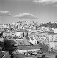
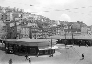
From the empty rubble emerged a vast square, then called Martim Moniz, a myth of the Christian reconquest and a convenient figure for the ideology of the Estado Novo. This space was partially filled in the 1950s with prefabricated pavilions for commercial activities, bus and streetcar stops and a parking lot. A decade later , in 1966, the metro network inaugurated its 13th station in the square's basement, then called Socorro (later Martim Moniz).
Between 1950 and 1975 various studies and plans were carried out for Martim Moniz, as part of the Lisbon Urbanization Master Plan. The proposals put forward followed the European ideas of the time, proposing major ruptures with the existing urban fabric, monumental buildings and highways. In 1994, the Lisbon Municipal Master Plan defined an Operational Planning and Management Unit for Martim Moniz, the objectives of which were implemented in 1997, with an underground parking garage being built and a central square with a circular road system on its surface. It was the construction of this proposal that transformed the Martim Moniz site into the square we know it as, and it was given the official name of Praça Martim Moniz by Edict of 15/12/1997.
Throughout this century, the square has been the scene of multiple initiatives promoted by the municipality and aimed at those who share it on a daily basis or who visit it for this purpose, consequently generating a peculiar attraction, new uses, practices and experiences.
This is the space we want to be experienced and recognized by all, perpetuating its historical identity, so that together we can draw a memory of the city's future.
A portrait of yesteryear

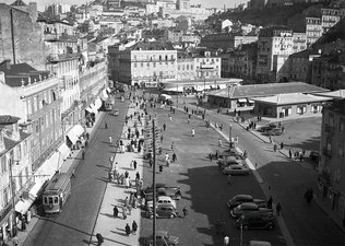
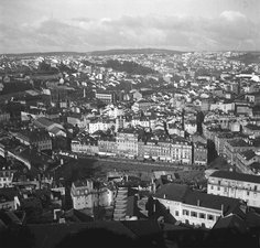
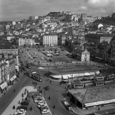
Axle evolution
![[Translate to English:] 1650 [Translate to English:] 1650](/fileadmin/informacao/dossies/mmoniz_requalif/pmm_ort1_01.jpg)
![[Translate to English:] 1761 [Translate to English:] 1761](/fileadmin/informacao/dossies/mmoniz_requalif/pmm_ort2_01.jpg)
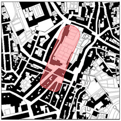
![[Translate to English:] 1950 [Translate to English:] 1950](/fileadmin/informacao/dossies/mmoniz_requalif/pmm_ort4_01.jpg)
Creation of the toponym "Rua Martim Moniz" awarded by the Municipality of Lisbon.
Information on toponymy
Exhibition "Praça Martim Moniz From memory to the future"
An exhibition about the square

