Ir para conteúdo principal ou rodapé
Na Minha Rua
Loja Lisboa
pictograma lupa
pictograma telefone
en

Serviços municipais

Contactos e links úteis

Agendamento de atendimento
Contacte-nos
800 910 211 / 218 170 552
Lojas de atendimento Todos os canais de comunicação Equipamentos municipais
Português
English
Informação Informação
  • Schedule
  • Thematic dossiers
  • News
    • Administrative
    • Municipal Bulletin
    • Themes

    Ecossistema

    • Informação
    • Transparência
    • Cidadania
    • Revelar
    • Serviços
  • Reports
  • Ecossistema

    • Informação
    • Transparência
    • Cidadania
    • Revelar
    • Serviços

Eixo Almirante Reis

Section 1
  • Entry
  • About the axle
  • Objectives
  • Proposal
    • Section 1 (current)
    • Section 2
  • Participatory process
  • Entry
  • About the axle
  • Objectives
  • Proposal
    • Section 1 (current)
    • Section 2
  • Participatory process
Listen

Section 1

between Martim Moniz and Praça do Chile

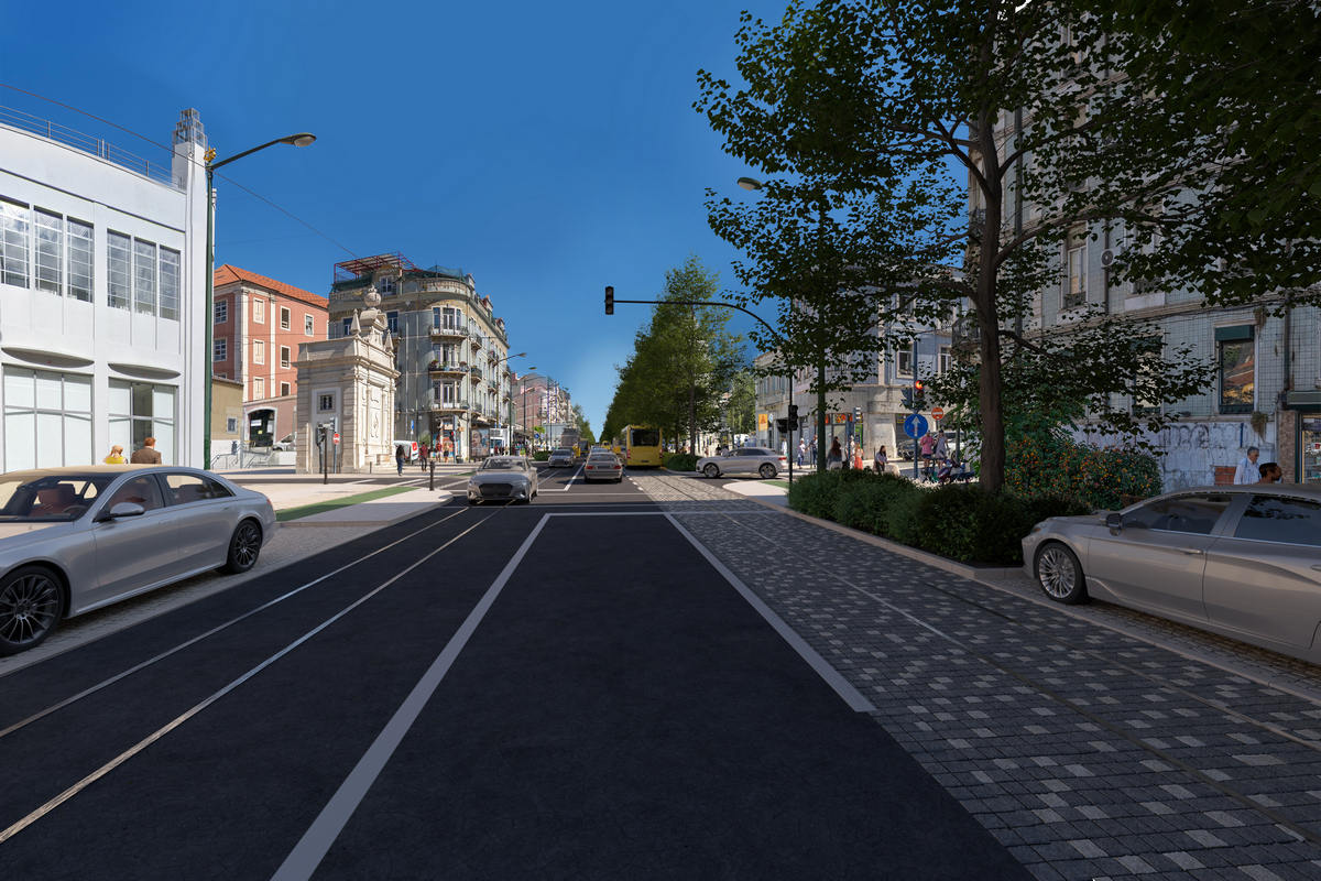
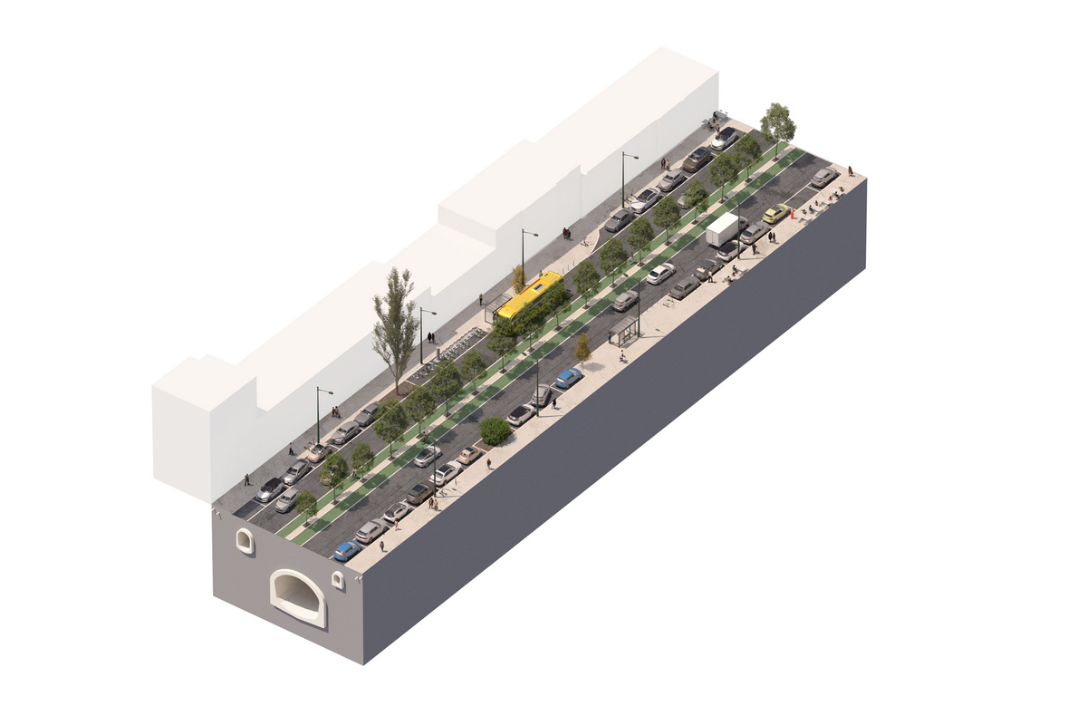
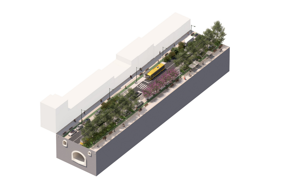
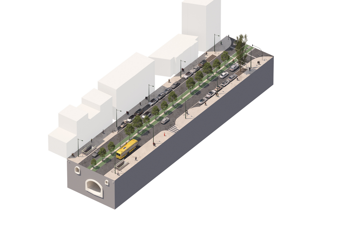
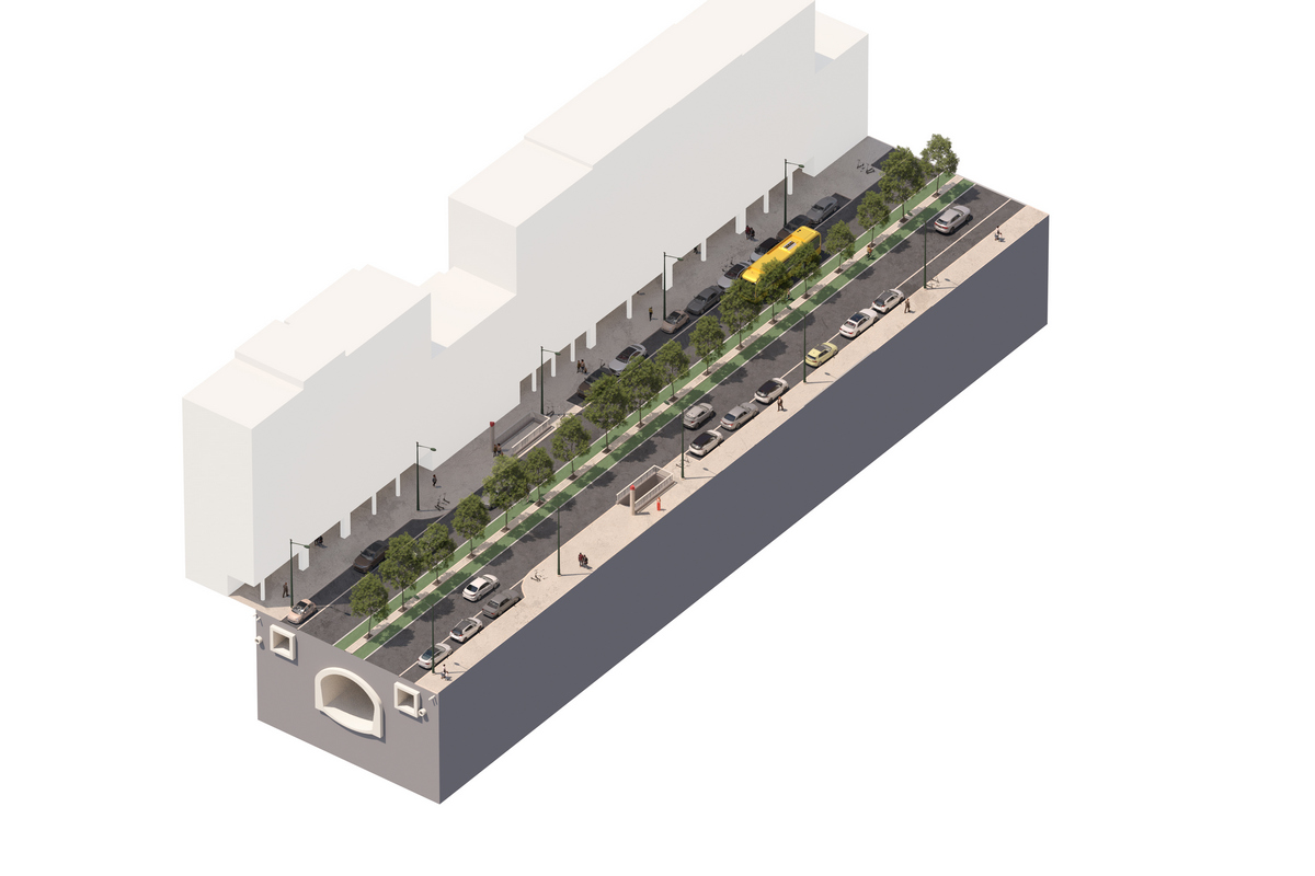
The first section, between Martim Moniz and Praça do Chile, has a profile made up of 3 lanes:

2 ascending lanes, to enable traffic to flow out of the city center: one lane is dedicated to public transport and the other to individual transport.

1 downhill l ane to restrict traffic access to the city center: the lane is shared (public and private transport).

This profile is in line with the ZER (Reduced Emissions Zone) for Baixa Pombalina.

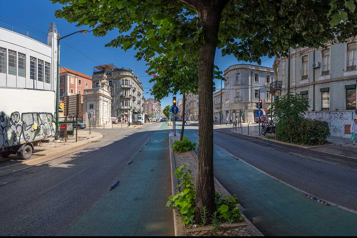
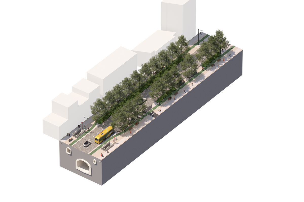
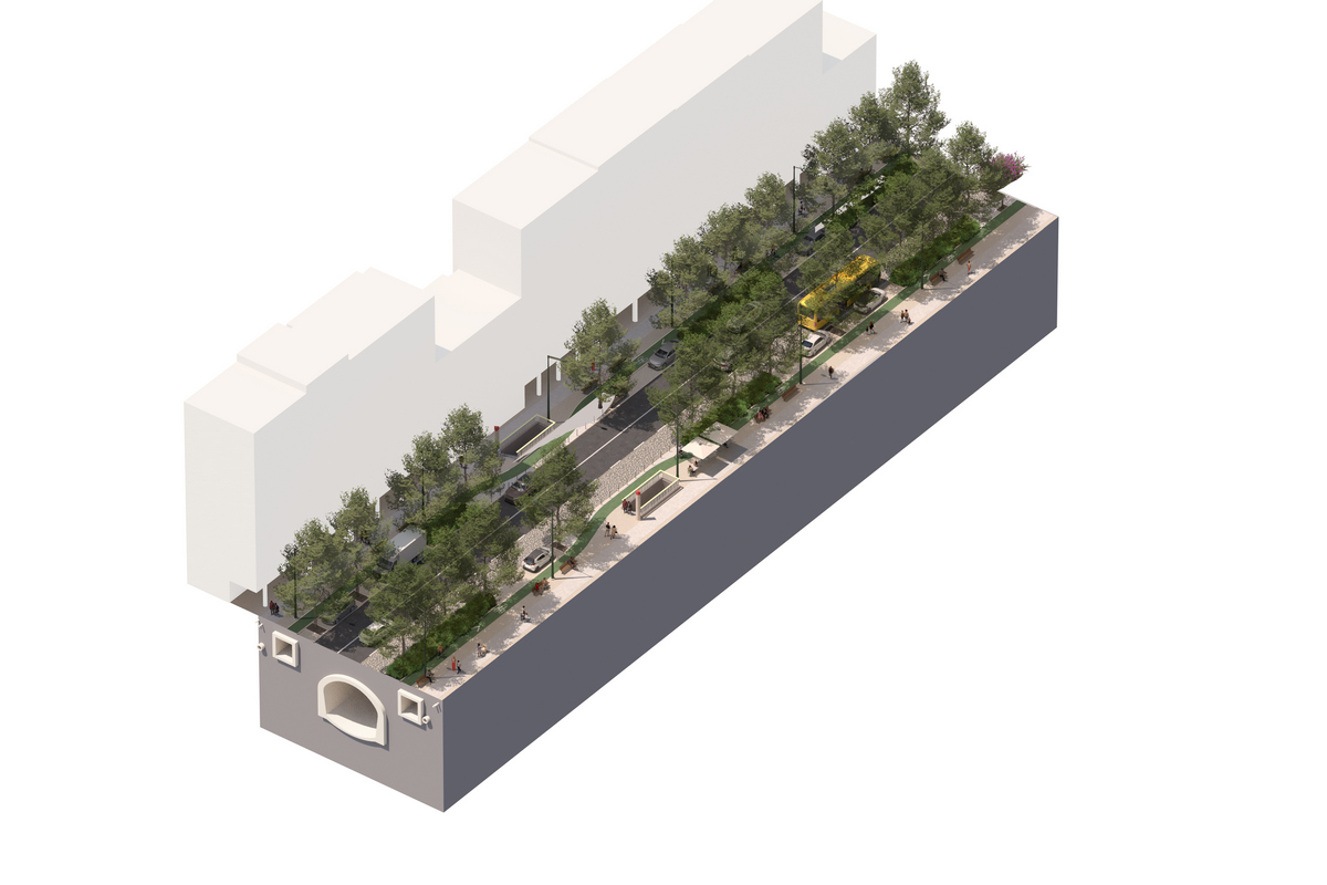
In this section , the cycle lane is segregated and unidirectional. It is located on each of the side sidewalks, responding to safety issues and allowing for better efficiency of the traffic light cycles (road-cycling-pedestrian). This option also facilitates access to the bicycle stops and connection to the clickable network around and across the axis.

Rua da Palma - existing and proposed profile
Show larger version
In night mode

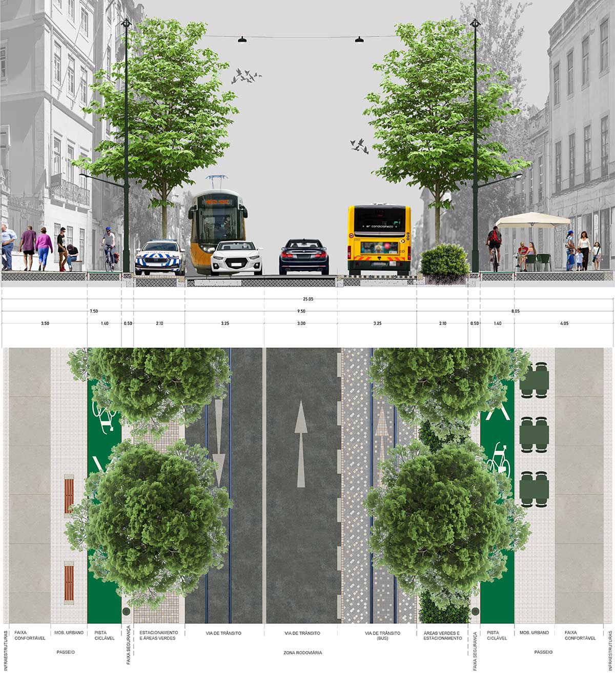
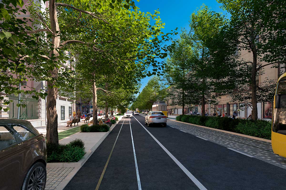
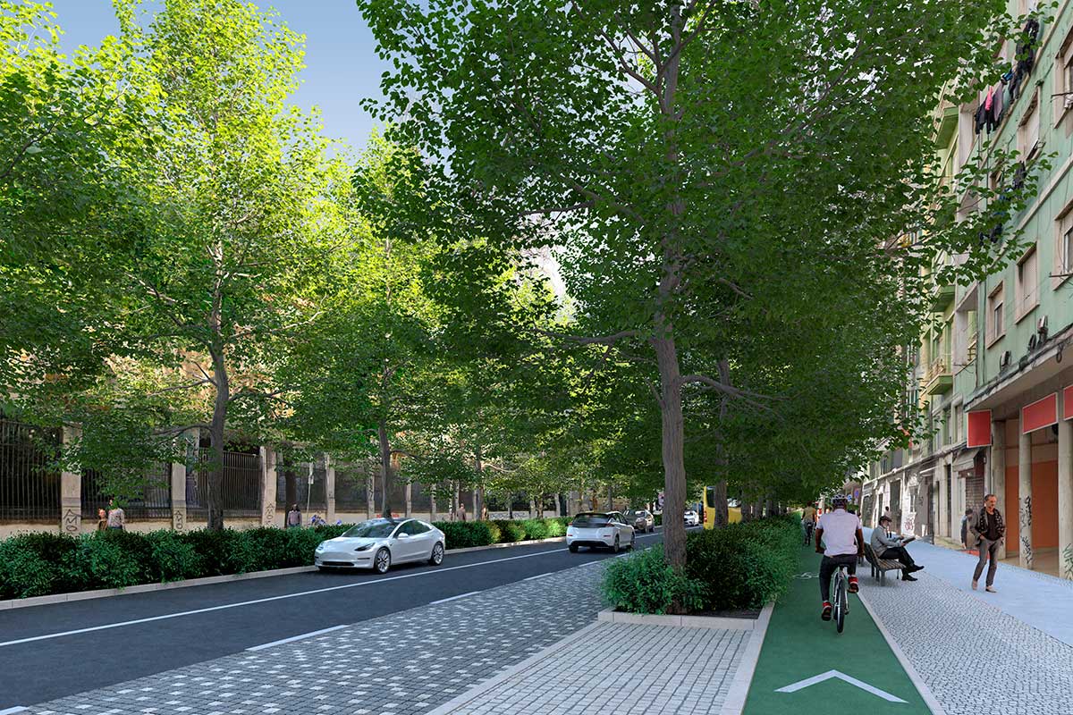
The roadway is located in the center of the canal space, maintaining the axial symmetry of the avenue. Next to the façades, the new profile includes on both sides a pedestrian area with a width of between 3.50 and 4 meters, where a comfortable circulation corridor of 1.70 meters and a space for esplanades and seating areas are located. Adjacent to the pedestrian area is a 1.40 meter wide one-way cycle path. This is followed by a 2.10 meter green strip with trees and shrubs, interspersed with parking spaces (priority and reserved) and public transport shelters.

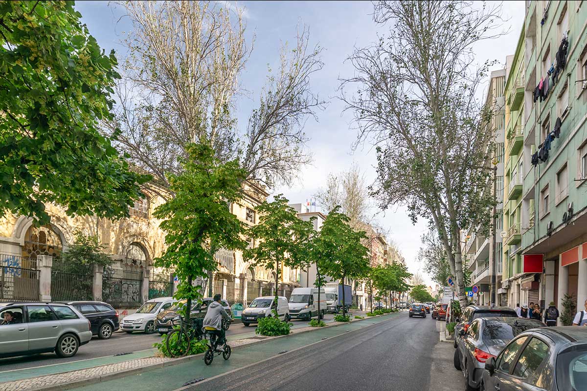
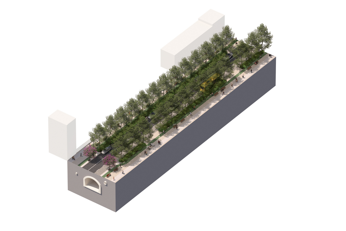
In this profile, a continuous tree structure becomes possible because it is implanted outside the limits of the current sidewalks, thus avoiding the complex system of existing underground infrastructures. However, occasionally, some of these infrastructures prevent the planting of trees, as is the case with the west/south sidewalk of Rua da Palma. In areas where it is not possible to plant trees, medium-sized shrubs will be planted, ensuring a continuous plant system along the entire axis.

The proposed transformation in a "before and after" comparison

Angels - South
Church of the Angels
Fountain - Intendente - South
Rua Francisco Foreiro - north

High perspective view

Show larger version for: Intendente - south - BEFORE
Intendente - south - BEFORE
Show larger version for: Intendente - south - AFTER
Intendente - south - AFTER
Show larger version for: Church of the Angels - BEFORE
Church of the Angels - BEFORE
Show larger version for: Church of the Angels - AFTER
Church of the Angels - AFTER
Show larger version for: Rua Francisco Foreiro - north - BEFORE
Rua Francisco Foreiro - north - BEFORE
Show larger version for: Rua Francisco Foreiro - north - AFTER
Rua Francisco Foreiro - north - AFTER
Show larger version for: Rua Pascoal de Melo - north - BEFORE
Rua Pascoal de Melo - north - BEFORE
Show larger version for: Rua Pascoal de Melo - north - AFTER
Rua Pascoal de Melo - north - AFTER

© Câmara Municipal de Lisboa - Política de privacidade, Termos de utilização e Política de cookies

    Condicionamentos na circulação