

is strongly affected by high temperatures;
the existing trees are insufficient to minimize the effects of high temperatures;
there are no crosswalks with universal accessibility;
air quality is not recommended for public health due to the intensity of road traffic;
noise levels are higher than those set out in the General Noise Regulation for mixed zones, at night - Ln and daytime - evening - Lden (with reference values of Ln>55 dB(A) and Lden>65dB(A));
there are no benches or rest areas;
60% of the sidewalk is used for road traffic and only 28% for pedestrians;
the pedestrian route is frequently interrupted by obstacles.
Reports, Plans and Studies - 2024
The characterization and diagnosis of the public space of the Almirante Reis axis - Part I of this document - covers the whole of Rua da Palma, Avenida Almirante Reis, Praças do Chile and Areeiro and all the adjoining public spaces, namely: Largo do Intendente, Jardim António Feijó, part of Alameda D. Afonso Henriques and Praça João do Rio. The document also includes the public participation process - Part I.
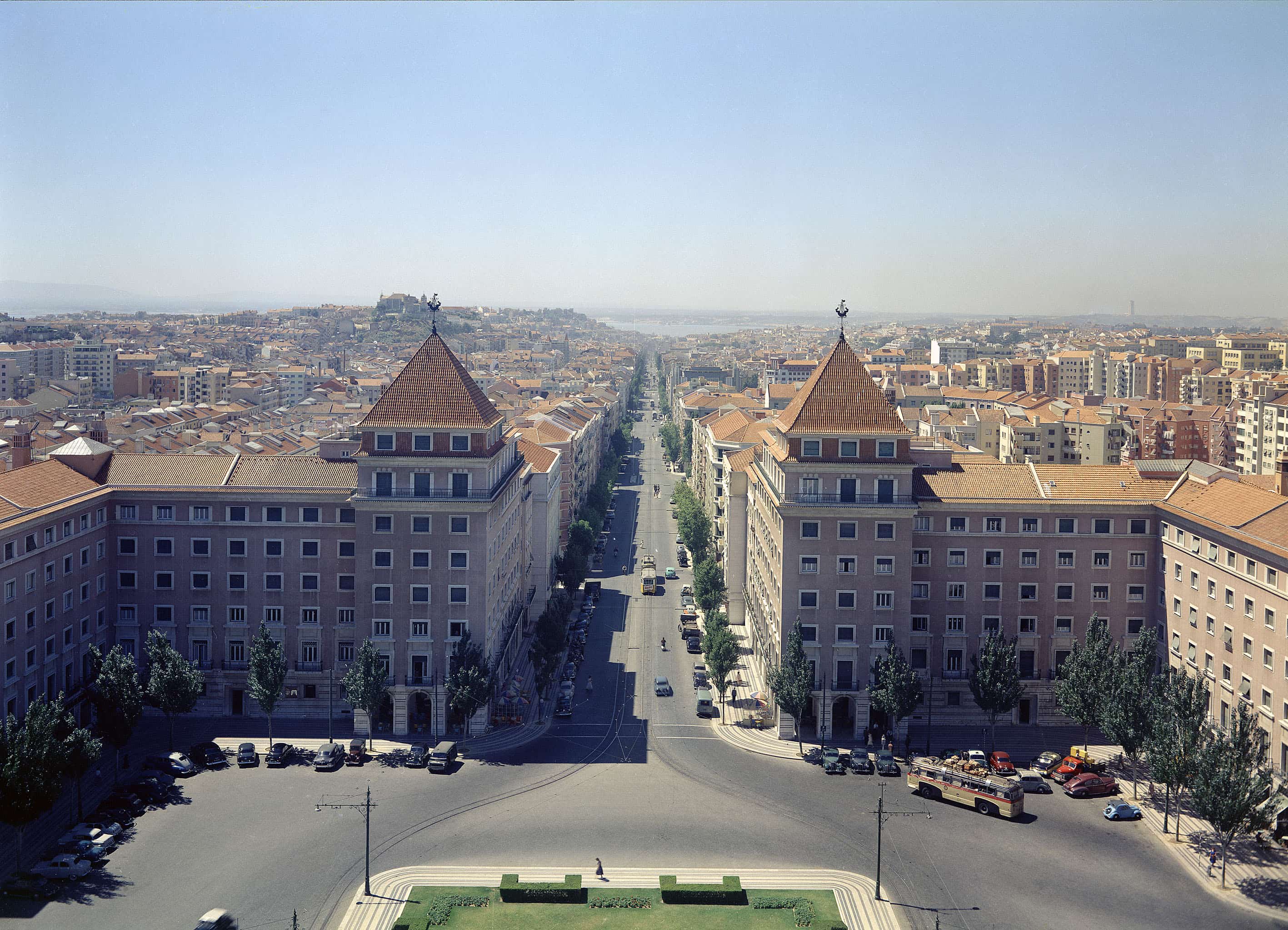
The axis is 2.9 km long and has an almost constant width of 25 meters. The narrow width of the axis is a major constraint on mobility and pedestrian accessibility. It has limited road space, about 13m wide, and relatively narrow sidewalks with an average width of 3.5m.
In terms of mobility, it is an important route into and out of the city center and, at the same time, at a local level, it provides access to around 11 neighbourhoods. Along its entire length, it is one of Lisbon's radial roads and the section between Febo Moniz and Praça do Chile is crossed by the 5th ring road. This axis is also a privileged access channel to the S. José hospital and the hospitals on Sant'Ana hill. The cycle path runs unidirectionally between Martim Moniz and Alameda D. Afonso Henriques and bidirectionally between Av. de Paris and Praça do Areeiro. In the unidirectional section, it runs along the center of the road axis on either side of the central divider. In the bidirectional section, it runs along the road axis next to the kerb of the east sidewalk. The cycle path has serious safety deficiencies. The lack of effective segregation between modes of transport and the absence of protective measures create highly vulnerable situations for cyclists. Urgent improvements are clearly needed to ensure a safe and comfortable route for cyclists.
Pedestrian accessibility has several limitations and constraints. The axis has a dense public transport network and a great deal of commercial activity, resulting in a high pedestrian density in some sections, particularly between Praça do Martim Moniz and Praça do Chile and in the area of Alameda D. Afonso Henriques. The narrow width of the sidewalks is aggravated by the almost continuous existence of pockets of car parking and by the large number of obstacles along their length, such as the existence of lampposts in the center of the pedestrian routes, the existence of open and closed terraces and other elements - accesses to the Metro, utility boxes, vertical signs, fire hydrants, newsstands, etc. - which hinder pedestrian circulation. Universal pedestrian accessibility is not guaranteed along the entire Almirante Reis axis. The axis lacks adequate infrastructure for people with reduced mobility. This situation creates significant barriers for people with reduced mobility and limits their access to various spaces.
There is a complex network of underground infrastructures on the Avenida Almirante Reis axis. The metro structure is located under the road axis and the drainage network collectors, public lighting and other utilities are located on the sidewalks to the side. The location of the drainage network is responsible for the near absence of trees on the sidewalks and the consequent planting of the tree structure in the center of the road, over the Metro infrastructure. This planting was possible because the Metro infrastructure is, on average, about 3m deep in relation to the surface level of the sidewalk.
The tree structure of the axis is characterized by the existence of a single alignment of trees (linden trees) on the central separator, with most of the specimens having a lower than normal development/support. The almost non-existent tree structure on the sidewalks is particularly serious due to the north/south orientation of the Almirante Reis axis, which promotes the formation of an urban heat island, characterized by significantly high temperatures. The absence of trees and adequate shading exacerbates this phenomenon, making the urban environment uncomfortable and detrimental to the health of residents and visitors. The lack of shaded areas prevents the creation of living spaces and reduces the quality of the urban environment.
The lack of seating areas along the axis - benches and rest areas - limits the possibility of resting along the axis. The presence of rest areas is essential to promote the well-being of citizens and encourage the use of public spaces for social and leisure activities. The lack of these areas compromises the axis' function as a pleasant and inclusive urban space.
- Characterization and diagnosis (part 1)
- Characterization and diagnosis (part 2)
Mobility Study - Phase, current characterization
February 2024
Socio-demographic information
The Almirante Reis axis is an important vector for structuring the city of Lisbon, linking the historic center on the east side to the city's expansion areas to the north. It benefits from a transport network and accessibility to various services and concentrates a large number of local shops.
Avenida Almirante Reis and its surrounding area are home to communities from different geographies (South America, East Asia and Southeast Asia), which is reflected in a clear cosmopolitan dynamic and the presence of different cultural heritages in the area.
The composition of the resident population follows the influence of the development periods of the avenue itself (and the city), which includes an elderly population closely linked to the rural exodus of the 60s and communities from Portuguese-speaking African countries, as well as Indo-Portuguese immigrants from the migratory flows of the 70s.
On the other hand, from the end of the 1990s onwards, groups of immigrants from Eastern Europe and, more recently, people from various parts of Asia have settled and worked in this part of the city, contributing to its multiculturalism.
The study area (AE) defined around Av. Almirante Reis covers around 230 hectares, or 2.3 km2, and has a population density of 18,360 inhabitants per km2, more than three times the city average.
When the 2021 Census was carried out, this area totaled:
a population of 42,132 individuals, corresponding to 7.7% of the municipality's population;
in terms of age distribution, the young population (aged 14 or under) accounted for 10.6% and the elderly population (aged 65 or over) accounted for 21.1%;
compared to the previous census (2011), the population of the EA increased by almost 4%, and if we focus only on the subsections flanking Avenida, there was a growth of 111.9%, from 3,339 individuals in 2011 to 7,074 in 2021.
There are four parishes whose territory is partially covered by the EA - Areeiro, Arroios, Penha de França and Santa Maria Maior.
Arroios is the parish that contributes the largest part of the territory included in this area (1.3 km2) and also has the largest population - 24,912 inhabitants, 59.13% of the EA's population.
As mentioned above, the population density of this area is quite high, corresponding to more than three times the city average. Similarly, both buildings and dwellings have a density per square kilometer with similar weights to the population.
The density of buildings is 1,547.8 per km2 and that of housing is 11,313.9 per km2.
Mobility System - Characterization in 2023
The cross-sectional profile of the avenue is 25 meters wide
Area allocated to the pedestrian mode 28% - the canal does not guarantee universal accessibility and presents a multitude of architectural barriers. This area includes metro ventilation, metro access, flowerbeds, technical cabinets, signage and bicycle racks;
Area allocated to the cycle path 12% - the current cycle path emerged from a canal reserve, in a pandemic environment, and does not meet the ideal conditions for mobility from the point of view of road safety;
Area allocated to the road channel 38% - where public and private transport circulates, but also the use of illegal parking;
Area allocated to the various legal parking lots 18%;
Area allocated to the central separator (tree axis) 4%.
Obstacles to the universal accessibility of pedestrian channels:
- different widths and lack of continuity, often interrupted by obstacles that require the detour of barriers with greater impact: - subway vents - flowerbeds - infrastructure boxes - street lamps - lack of alignment - street furniture - terraces;
- lack of legibility;
- lack of information / signage;
- materials used in coverings prevent universal accessibility;
- the type of sidewalk and the poor condition and conservation of the coverings are also obstacles to mobility for everyone, especially those with motor disabilities;
- pedestrian crossings do not comply with universal accessibility rules;
- on the Almirante Reis axis there are:
- 89 pedestrian crossings with a traffic light system;
- 38 pedestrian crossings without traffic lights;
- average distance between crosswalks: 132 meters;
- minimum distance between crosswalks: 60 meters (average walking time about 50 seconds);
- maximum distance between crosswalks: 310 meters (average walking time about 4.30 minutes).
- the cycle path on Avenida Almirante Reis (AAR) and Rua da Palma (RP) is used by people with reduced mobility, pedestrians and joggers because it has comfortable and safe sidewalk.
"Comparing the mobility figures for the AAR with those for the rest of the city, we can see that: In the AAR there is a greater number of pedestrian journeys, greater use of the metro and less use of the car. In addition, the use of soft modes by residents of the parishes surrounding the AAR is double that of most of the city." Source: IMOB2020 Indicators
According to the report by IST - Civil Engineering Research and Innovation for Sustainability (CERIS), Counts of Cyclists and Trotinetists, November 2022 campaign report, the variation in the hourly volume of cyclists observed in the 4 common peak hours is as follows:
| Location | 2017 | 2018 | 2019 | 2020 | 2021 | 2022 | |
| H3 | Av. Almirante Reis / R. Pascoal de Melo | 26 | 33 | 30 | 79 | 135 | 153 |
| H4 | Av. Almirante Reis / R. dos Anjos | 28 | 30 | 30 | 69 | 95 | 120 |
- the implementation of the cycle channel reservation on the RA axis has led to a significant and continuous increase in the volume of cyclists since its implementation (early 2020);
- according to the aforementioned report "This continues to be the axis with the greatest and continuous increase in bicycle and scooter users since its implementation...";
- it should also be noted that "The number of couriers has increased significantly over the last three years, especially on the Av. Almirante Reis / Av. Roma, Baixa / Av. da Liberdade and Eixo Central axes. The percentage of couriers among the cyclists observed was 13.2% on average (it was 9% in October 2021), reaching 36% between 7pm and 8pm."... (IST);
- given the volume of cyclists on the RA axis, there are not enough parking spaces dedicated to these vehicles;
- there are two GIRA bike-sharing stations and 3 on nearby streets;
- the avenue has one road channel per direction with a width of about 4.50 meters;
- the excess width of the road channels makes irregular parking possible;
- the excess width of the road channels makes speeding possible outside of rush hour;
- the timing of traffic lights prioritizes road traffic along the axis throughout the day;
- the lack of adequate traffic management on the axis means that there is a significant volume of stationary traffic in the surrounding area;
- overtaking often occurs, partially occupying the cycle lane, a situation that should only happen in emergency traffic;
- the stretch of Av. Almirante Reis between Rua Febo Moniz and Praça do Chile is part of one of the city's circular routes (5ª Circular) where the aim is for traffic to flow smoothly, avoiding traffic passing through neighborhoods. In this regard, it is important to note that, in the south-north direction, the city's circular axis (5th Circular) is not in operation, since the left turn at Rua Febo Moniz is not allowed. This means that all traffic wishing to continue on the 5th ring road or access it via the AAR has to take a detour through a residential area, Rua Passos Manuel, where there is a school and a public garden that is very popular with children.
Only Carris 708 runs along its entire length.
cARRIS 708
The remaining routes have the following frequencies during the morning and afternoon rush hours on the different sections:
Morning rush hour - HPM - (from 7 am to 9 am)
- E28, 708 and 734 - section - Praça do Martim Moniz - Rua da Palma
total CARRIS routes
- 31 south/north
- 29 north/south
708 - section - Rua Andrade - Rua Pascoal de Melo
total CARRIS routes
- 9 south/north
- 10 north/south
706, 708 and south/north to 17B - section - Rua Pascoal de Melo to Praça do Chile
total CARRIS routes
- 23 south/north
- 30 north/south
708, 717, 718, 735, 797 - section - Alameda Afonso Henriques
total CARRIS routes
- 57 south/north
- 57 north/south
708, 717, 718, 720, 735 - section - Alameda Afonso Henriques-Praça do Areeiro
total CARRIS routes
- 51 south/north
- 60 north/south
Afternoon rush hour - HPT - (from 5 p.m. to 7 p.m.)
E28, 708,734 - section - Praça do Martim Moniz- Rua da Palma
total CARRIS routes
- 32 south/north
- 33north/south
708 - section - Rua Andrade - Rua Pascoal de Melo
total CARRIS routes
- 9 south/north
- 9 north/south
706, 708 and south/north to 17B - section - Rua Pascoal de Melo to Praça do Chile
total CARRIS routes
- 21 south/north
- 18 north/south
708, 717, 718, 735, 797 - section - Alameda Afonso Henriques
total CARRIS routes
- 51 south/north
- 48 north/south
708, 717, 718, 720, 735 - section - Alameda Afonso Henriques-Praça do Areeiro
total CARRIS routes
- 55 south/north
- 50 north/south
With regard to validations (journeys) on the route, and with reference to January 4, 2023, (because the IST is in exam period, the figures provided by CARRIS may not correspond to a typical day, and it is expected that there will be greater demand at other times of the calendar) in the morning rush hour, between Praça do Martim Moniz and Praça do Areeiro, we have 774 validations and in the afternoon rush hour, 1009 validations, with a daily total of 6633 validations.
The route with the highest number of validations is the 708, which has 1708 validations in both directions on January 4, 2023.
Parking on the axis is permitted and regulated by EMEL
There are 350 surface parking spaces, of which:
- 170 are spaces charged by EMEL - "Rotation - The average duration of parking is 1 hour" EMEL;
- 180 reserved spaces, distributed as follows:
- 33 private;
- 60 loading and unloading
- 23 passenger drop-offs and pick-ups 12 people with reduced mobility 10 motorcycles
- 16 bicycles and hotsptot
- 26 others
There are also 707 structured parking spaces in the axis, distributed over 3 priced parking lots.
Parque da Alameda - Empark: 498 spaces, with 150 spaces for residents on a rental basis. There are plans to install a bike rack in this park, in an area corresponding to a car parking space.
Praça do Chile Park/Rematar Ideias Unipessoal Lda.: 104 spaces.
Hotel Travel Park: 95 spaces.
Test run of the avenue axis from south to north
carried out on February 14th and 15th by the DEPM team
On February 14, 2023, a test was carried out with the assumption that the avenue would run from the south (Praça do Martim Moniz) to the north (Praça do Areeiro) at 9.00 a.m. and 4.45 p.m., with the following route times recorded:
- on foot 40 minutes at both times;
- by electric bicycle 11 minutes at both times;
- by Carris bus (708) 12 minutes in the morning and 17 minutes in the afternoon;
- by metro 10 minutes at both times;
- by car 10 minutes in the morning and 20 minutes in the afternoon.
Testing the route of the avenue axis from north to south
On February 15, 2023, the same test was carried out, but from north (Praça do Areeiro) to south (Praça do Martim Moniz) at 9:00 a.m. and 4:45 p.m., with the following journey times recorded:
- on foot 36 minutes at both times;
- by conventional bicycle 10 minutes at both times;
- by Carris bus (708) 15 minutes in the morning and 13 minutes in the afternoon;
- by metro 10 minutes at both times;
- by car 13 minutes in the morning and 11 minutes in the afternoon.
According to this experience, the best way to get around the AAR was by bicycle and metro.
Environment - Characterization reports
Site characterization and historical overview
Lisbon City Council tree grove
The tree layer is made up of a central alignment of Tilia cordata and Tilia platyphyllos, and 2 lateral alignments, to the west and east, with specimens of Acer platanoides, Liquidambar styraciflua, Populus alba bolleana, Populus nigra var. italica, Robinia pseudoacacia var. pyramidalis.
The lateral alignments show great discontinuity, either due to the current profile of the avenue, or due to the progressive felling of specimens of the Populus sp. genus that are in the senescence phase. The Populus specimens, the oldest on the avenue, generally show signs of decay, lesions resulting from the removal of legs, many of which have cavities that compromise stability. On the southern stretch up to the Plaza de Chile, the trees on the lateral alignments are mostly located in raised beds.
Of the 48 georeferenced points on the lateral alignments, 41 specimens were assessed, with the remaining 7 points referring to felled trees whose status in the Database refers to an empty boiler.
In the central separator there are 257 boilers in a single alignment, 3 of which are empty or with a stump, and 254 specimens of the genus Tilia sp.were observed.
The linden trees installed in the central separator are conditioned by the lack of soil available for root development due to the presence of infrastructures, namely the Lisbon Underground tunnel, and in general their crown development is much lower than expected for the species/genus. Although it is neither foreseeable nor expected that the crowns of these trees will reach the usual size of a tilia and that which would be necessary to overshadow the entire road lanes, the presence of this alignment, taking into account its tight compass, constitutes a fundamental presence for climate mitigation on this road, without which it would be intolerable, for example, to use the cycle path that the urban heat island map for Lisbon in this area has quite negative characteristics, as shown in the image of the heat island for Lisbon. It is clear from the map that the afforestation of this avenue is insufficient to minimize the effects of high temperatures.
The presence of strong, healthy trees is one of the factors that can contribute most to regulating and mitigating the climate, positively altering the negative effects of climate change.
The lack of homogeneity of the trees on the side walks (which account for the largest percentage of leaf area) is a negative factor that should be corrected in future work on this artery, since there are few possibilities for improving the underground conditions in the central alignment.
This report aims to update the acoustic characterization of Avenida Almirante Reis for a more detailed assessment.
Rising temperatures will be the biggest climate threat by the end of the century, with consequent impacts on health.
Lisbon's average temperature has risen by around 2ºC since the second half of the 19th century.
The main climate changes projected for Lisbon by the end of the 21st century are as follows:
- Increase in average annual temperature (+1ºC to 4ºC);
- A sharp increase in the maximum autumn temperature (+2ºC to 5ºC);
- An increase in the number of days with a temperature of 35ºC and tropical nights;
- More frequent heat waves.
In the study area and during the most critical periods (heatwave situations and at dusk), the intensity of the Urban Heat Island could reach 2.0ºC to 3.5ºC, corresponding to the temperature differential for the reference zone, Lisbon airport.
To characterize the air quality in Av. Almirante Reis, given the lack of a fixed air quality measurement station in the area, it was decided to carry out an air quality measurement campaign, which took place from 26/10/2022 to 09/11/2022.
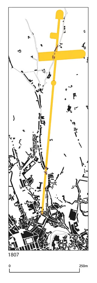
The valley that descends from Areeiro to Baixa is a natural route that has conditioned and determined the development of the entire surrounding area.
Archaeological knowledge of the area, although still sparse, shows traces of pre- and proto-historic occupation, at Largo de Santa Bárbara and Encosta de Santana, for example, as well as other remains from the Roman and Medieval Islamic periods that point to an ancient and multifaceted occupation of this fragment of territory.
The valley was rich in water, retaining this phenomenon in its place names (Arroios, Fontainhas, Charca, Regueirão) and was naturally used for farming. It also had the conditions for population agglomeration, which eventually led to the creation of parishes of its own.
The main cause of agglomeration and population growth in this area was the earthquake of 1755. Following this catastrophic episode, precarious housing was set up from Bemposta (Paço da Rainha) to Arroios to accommodate the many people who took refuge there.
The palaces and convents were also, as elsewhere, polarizers of urban growth, with examples such as the Convento do Desterro, Convento de Arroios (Society of Jesus and, later, of the nuns of the Conception of Mary), the now-disappeared Palácio dos Senhores de Pancas and the Palácio dos Condes de São Miguel/ Palácio dos Condes dos Arcos (in which the Leão brewery operated).
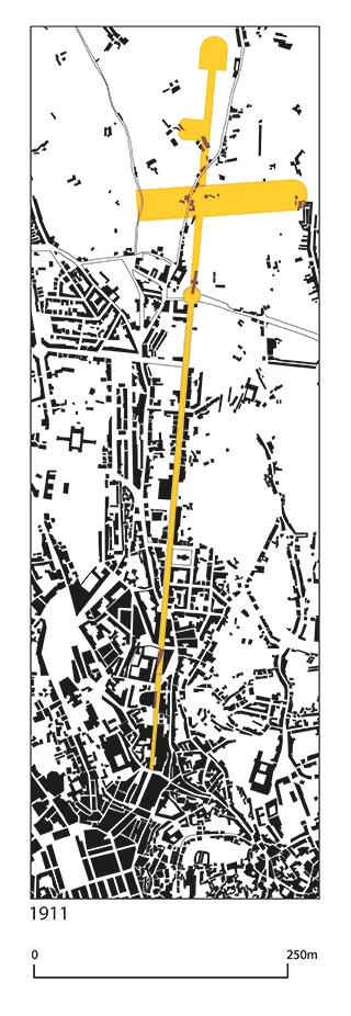
At the beginning of the 20th century, the city ended at Arroios. From there northwards, from the current Praça do Chile, in the area where Rua de Arroios intersected with Calçada de Arroios, Estrada da Charneca and Estrada de Sacavém, retreats proliferated, especially along the latter.
a story in five parts
A portrait of yesteryear
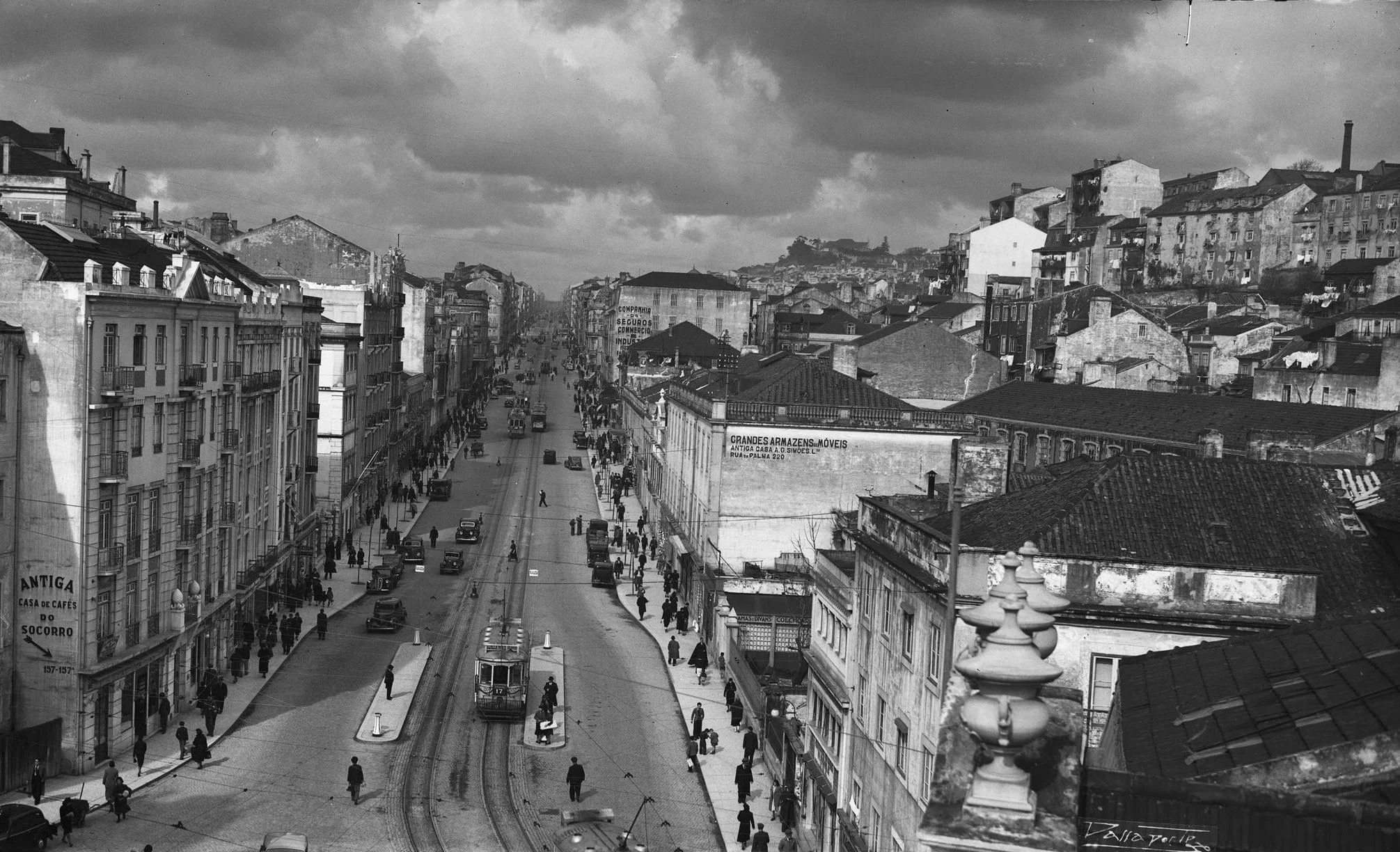
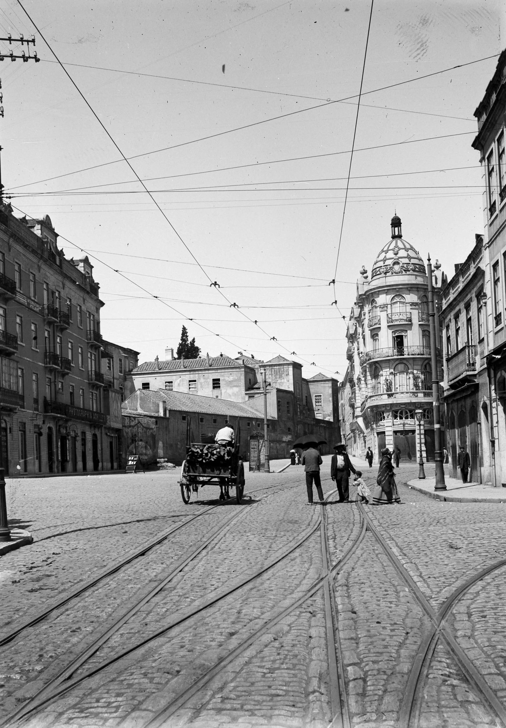
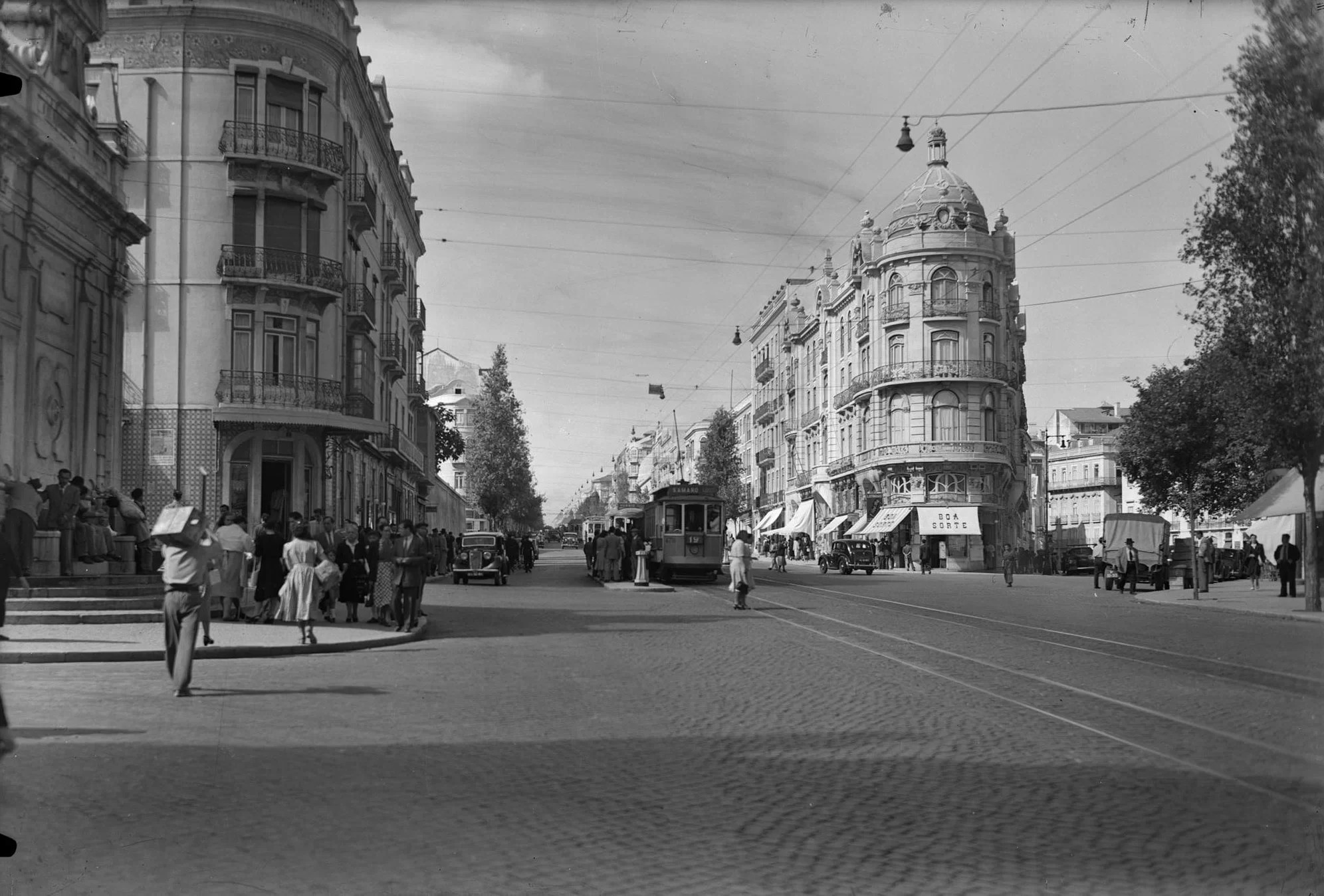
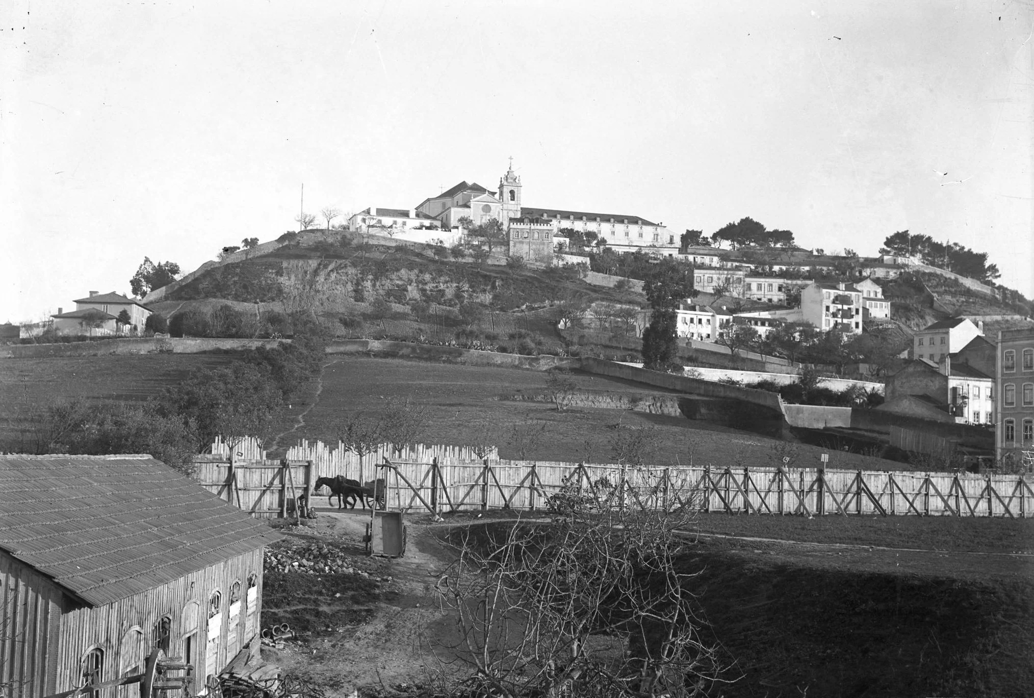
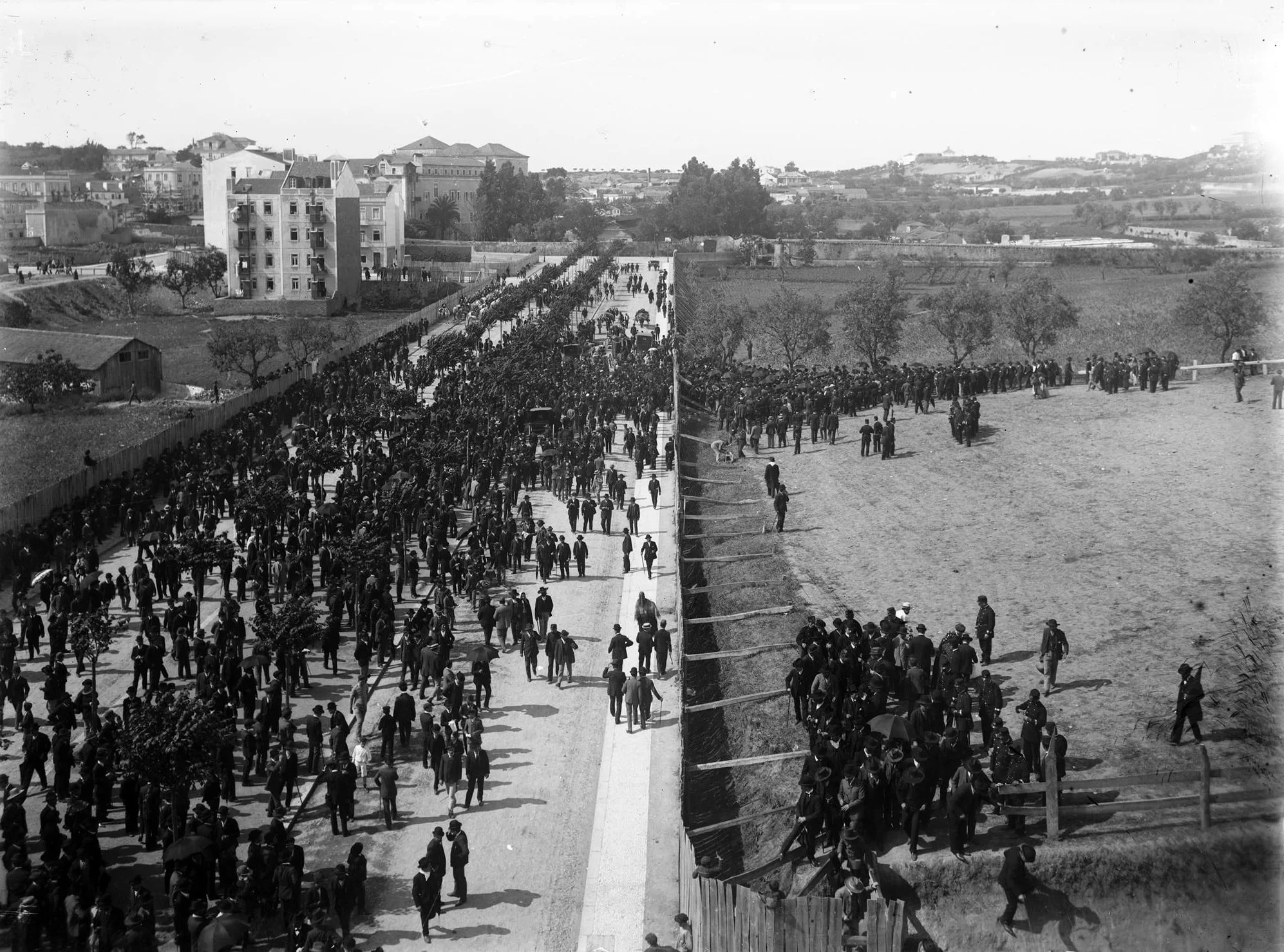
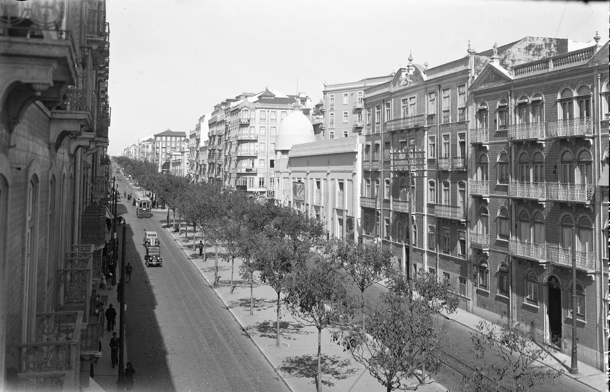
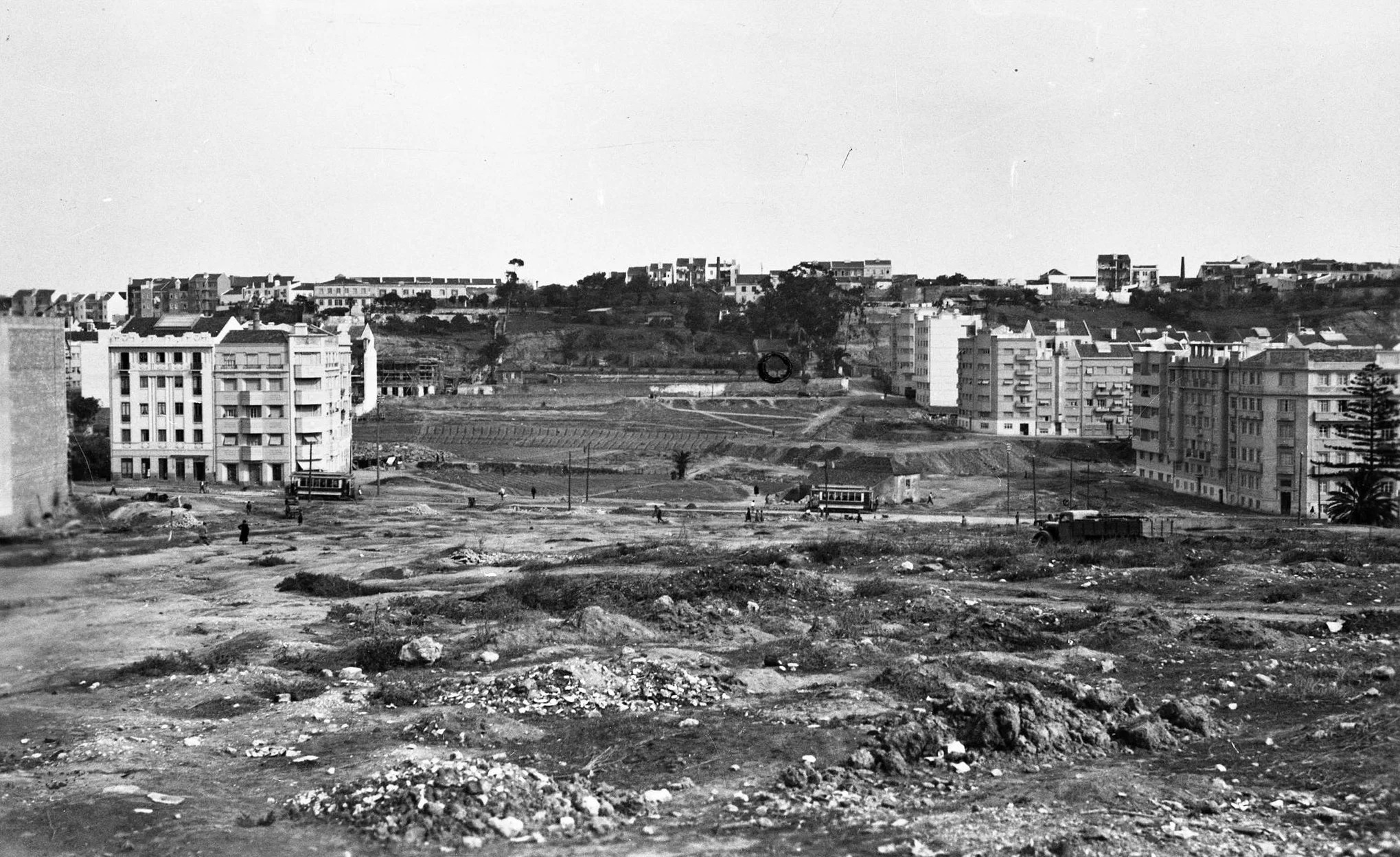
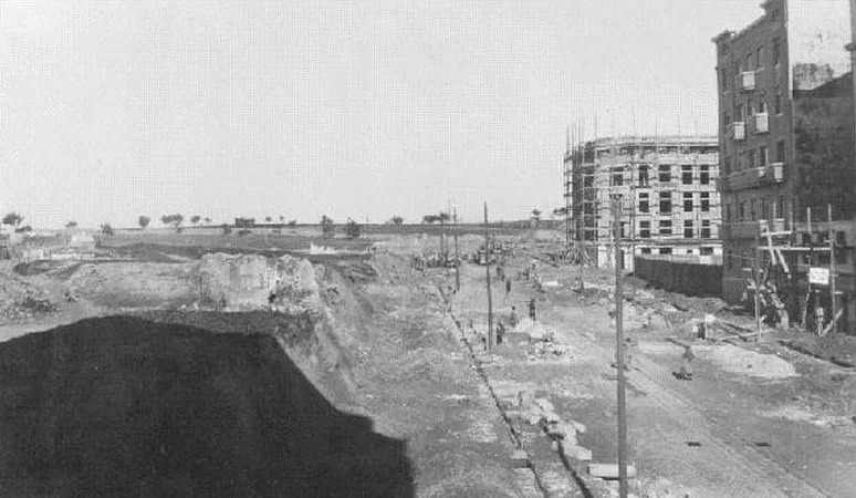
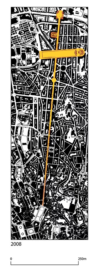
Axle evolution
Municipal magazine - Year 1 / No. 1